
©Visit Éislek

Houfëls

Where? Boulaide

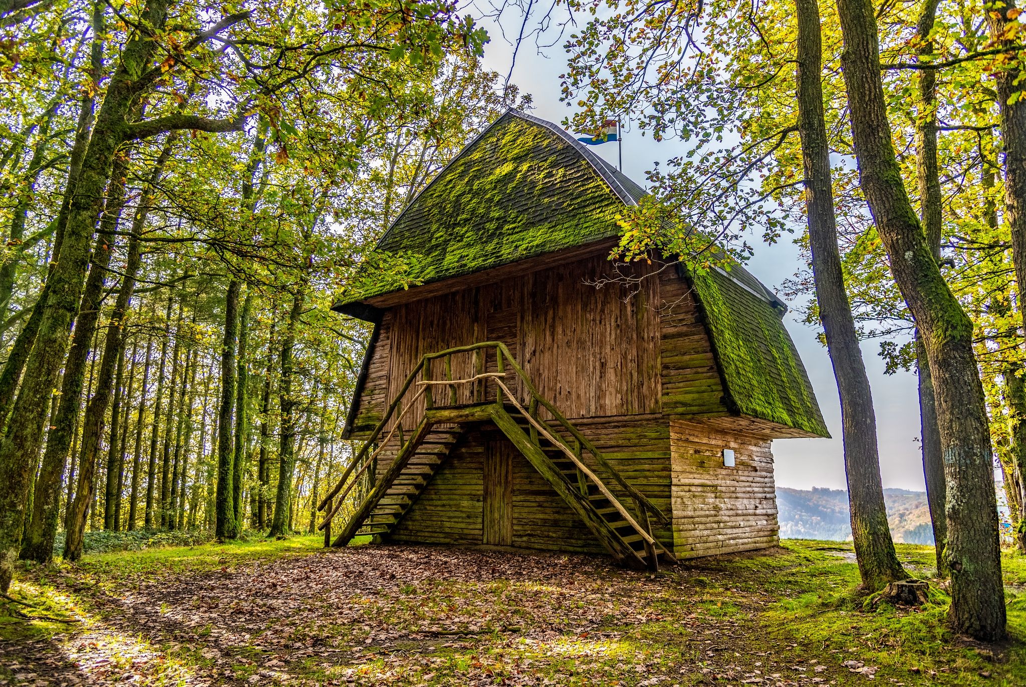
The ‘Houfëls’ (high rock) viewpoint near Boulaide offers a breathtaking view over the Sûre Valley and the Upper Sûre.

At an altitude of 457 metres, there is a pavilion that was built by the Hames family in 1934. Although the pavilion can only be viewed from the outside today, the place still invites you to take a break with a picnic and a panoramic view.

The viewpoint is located on several hiking trails, including the Éislek Pad Boulaide, the Autopédestre Boulaide and the Natur Pur? trail. It can also be reached by car.

For history buffs, there are two historical guns from the Second World War to discover at the rest area behind the pavilion: a German 8.8 cm PAK (anti-tank gun) and an American 155 mm cannon.
Contact

Address: Administration Communale de Boulaide
3, Rue de la Mairie
L-9640 Boulaide
Show on map

More sites

©Visit Luxembourg
Circular routes
Auto-Pédestre hiking route Munshausen
Distance: 8,68 km
Duration: 2:40 h
Difficulty: medium
Find out more
Noé Michèle & Marcel
ParkingSituated in the centre of townWifi
©AdobeStock
Bus stop - Insenborn, Wealerhaff
With the Stauséi-Navette, it is easy and convenient to park in the surrounding area and be transported directly to the bathing area. The shuttle takes you quickly and easily from the overflow parking lots to the beach and back. Enjoy a stress-free day at the lake.
Find out more
©Visit Luxembourg
Cycle path Benny (PC 23)
Distance: 2,11 km
Duration: 0:15 h
Difficulty: easy
Find out more
©Hotel Restaurant Brasserie Belle Vue
Restaurant Brasserie Belle Vue
Brasserie in Vianden with a terrace, daily specials, vegetarian options, and parking at the door. Part of Hotel Belle Vue.
Find out more
©Visit Éislek
Thematic paths
Cactus Bongert Nature Discovery Trail
Distance: 3,06 km
Duration: 1:00 h
Difficulty: medium
Find out more
©Hotel Anatura
SENSA - Restaurants & Lounge Bar
Restaurant and lounge bar in a 4-star superior hotel in northern Luxembourg with panoramic views.
Find out more
©Visit Éislek, Visit Éislek
Circular routes
Local Hiking Trail DK 2 - Diekirch (Fridhaff)
Distance: 5,49 km
Duration: 1:35 h
Difficulty: easy
Find out more
©Toutschenmillen Jim Wiltz
Toutschenmillen - Jim
Garden / Park