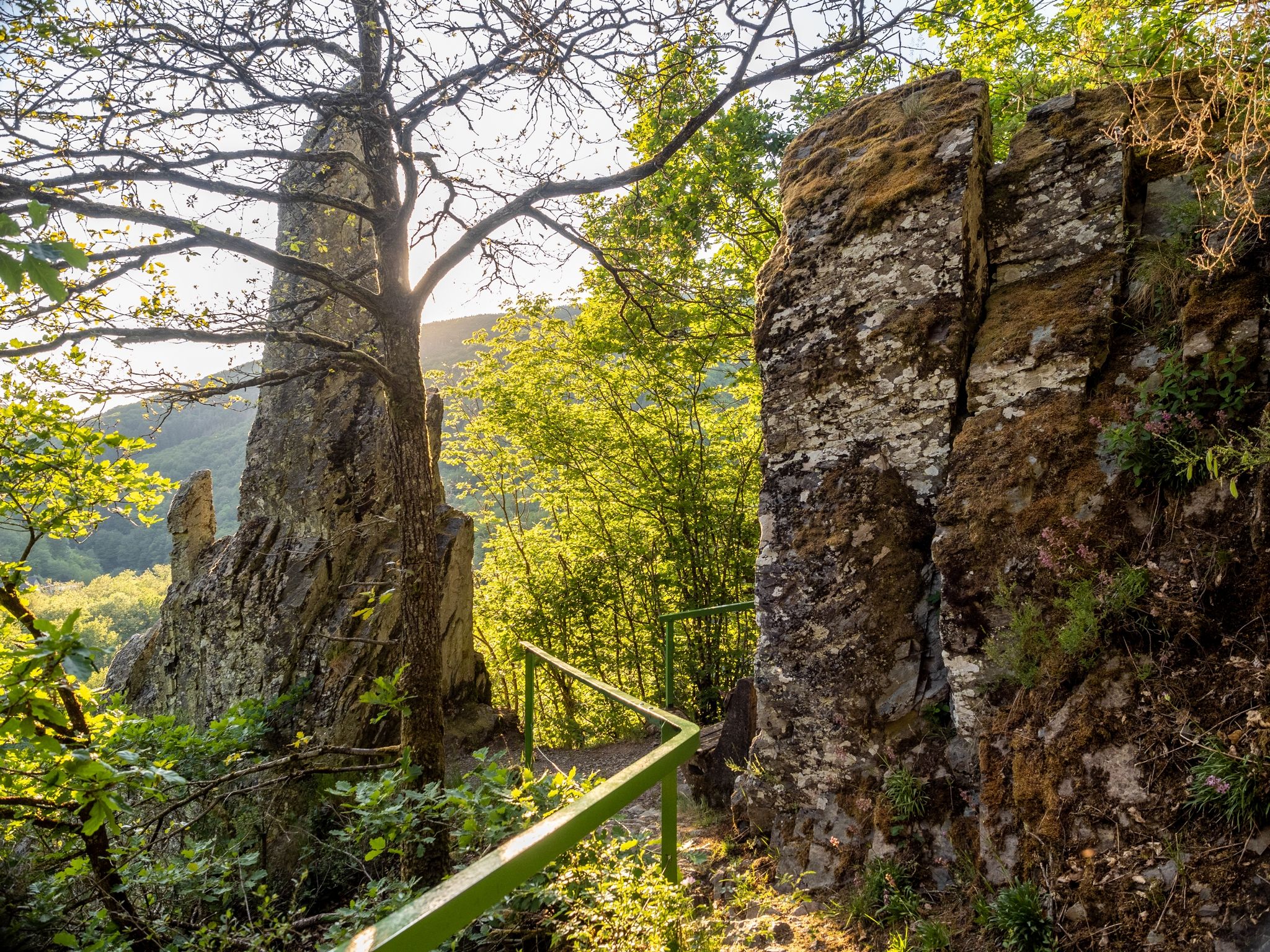
Doigt de Dieu

Discover the breathtaking "Doigt de Dieu" or Finger of God along well-known hiking trails like Escapardenne Lee Trail and Éislek Pad Hoscheid, offering a magnificent view from its perch above Dirbach.

Also called "Rouschteschleen", rusty rocks in Luxembourgish, these rocks displaying striking spires. This extraordinary alignment stands as one of Luxembourg's most captivating rock formations. Perched above Dirbach, this colossal rock is a geological wonder shaped by the gradual erosion of the Sûre river.

"Doigt de Dieu" or the “Finger of God” offers a sublime vista along renowned hiking trails like Escapardenne Lee Trail and Éislek Pad Hoscheid.

Contact

Address: Visit Éislek
L-9401 Vianden
Show on map

More sites

©Touristcenter Robbesscheier
Sammeshaff
Garden / ParkSituated in the centre of townWifi
©Dan Castiglia, Visit Éislek
Circular routes
Auto-Pédestre Hiking Trail Bettendorf
Distance: 11,74 km
Duration: 3:15 h
Difficulty: medium
Find out more
©Visit Luxembourg
Distance trails
CFL railway hiking trail 4 (Drauffelt - Kautenbach)
Distance: 16,13 km
Duration: 4:50 h
Difficulty: medium
Find out more
©Visit Luxembourg
Thematic paths
Naturpur? - Large Circular Route
Distance: 7,05 km
Duration: 2:10 h
Difficulty: medium
Find out more
©Visit Luxembourg
Circular routes
Local hiking trail BL 4 - Boulaide
Distance: 7,67 km
Duration: 2:15 h
Difficulty: medium
Find out more
©Ville de Diekirch
Esplanade Hotel
WifiRestaurantSituated in the centre of town
©Visit Éislek
Houfëls
The ‘Houfëls’ (high rock) viewpoint near Boulaide offers a breathtaking view over the Sûre Valley and the Upper Sûre.
Find out more
©Visit Éislek
Viewpoint Gringlee
The ‘Gringlee’ viewpoint, also known as ‘Gringlay’, offers an impressive panorama over the Sûre Valley and the majestic Bourscheid Castle. It is one of the most famous viewpoints in Luxembourg.
Find out more
©Sauerbuttik
Sauerbuttik
Small self-service farm shop in Erpeldange offering regional products.
Find out more